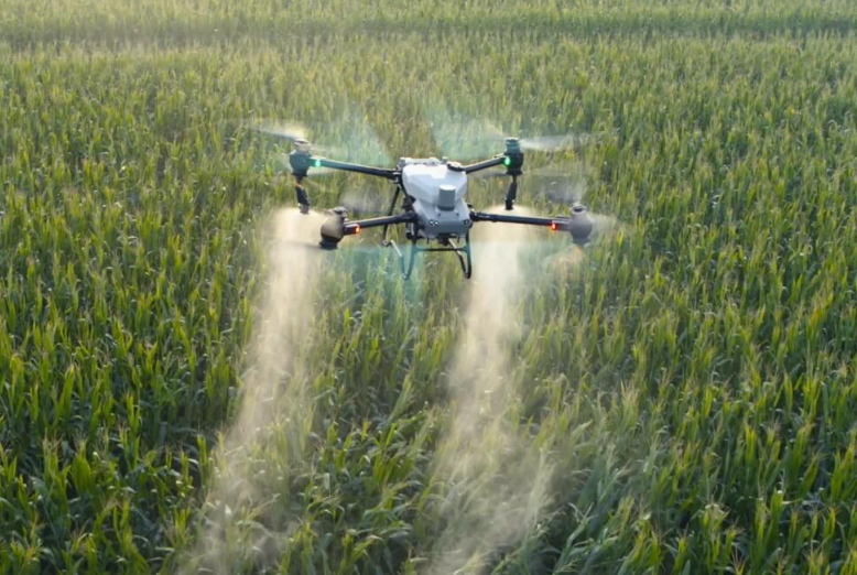
SZ DJI TECHNOLOGY CO., LTD. – Drone – DJI AGRAS T50

0,00

Technical Sheet: 

Structure & Flight Performance

  • Max takeoff weight: 92 kg (spraying) / 103 kg (spreading) at sea level

  • Max diagonal wheelbase: 2200 mm; dimensions unfolded: 2800×3085×820 mm

  • Max wind resistance: 6 m/s; configurable flight radius up to 2000 m

  • Hovering accuracy (RTK enabled): ±10 cm horizontal/vertical

Propulsion

  • 8 motors: stator 100×33 mm48 KV4000 W per rotor

  • Propellers: 8 nylon carbon fiber, 54 inches (1371.6 mm) diameter

Spraying System

  • Spray tank: 40 L HDPE, max flow 24 L/min (4 nozzles); droplet size 50–500 μm

  • Effective spray width: 4–11 m at 3 m height

Spreading System

  • Spread tank: 75 L, internal load 50 kg; compatible granules 0.5–5 mm

  • Spread width: 8 m

Sensors & Safety

  • Phased array radars (front/rear): 360° multidirectional obstacle sensing, range 1–50 m

  • Binocular vision: range 0.5–29 m, FOV horizontal 90°/vertical 106°

  • Terrain following up to 50° slope without mapping

Out of stock

SKU: 3778 Category:
The item has been assessed for digitalization/automation

Description

Technical Sheet: 

Structure & Flight Performance

  • Max takeoff weight: 92 kg (spraying) / 103 kg (spreading) at sea level

  • Max diagonal wheelbase: 2200 mm; dimensions unfolded: 2800×3085×820 mm

  • Max wind resistance: 6 m/s; configurable flight radius up to 2000 m

  • Hovering accuracy (RTK enabled): ±10 cm horizontal/vertical

Propulsion

  • 8 motors: stator 100×33 mm48 KV4000 W per rotor

  • Propellers: 8 nylon carbon fiber, 54 inches (1371.6 mm) diameter

Spraying System

  • Spray tank: 40 L HDPE, max flow 24 L/min (4 nozzles); droplet size 50–500 μm

  • Effective spray width: 4–11 m at 3 m height

Spreading System

  • Spread tank: 75 L, internal load 50 kg; compatible granules 0.5–5 mm

  • Spread width: 8 m

Sensors & Safety

  • Phased array radars (front/rear): 360° multidirectional obstacle sensing, range 1–50 m

  • Binocular vision: range 0.5–29 m, FOV horizontal 90°/vertical 106°

  • Terrain following up to 50° slope without mapping